A cut-off low-pressure system is expected to make landfall over western South Africa from Tuesday morning. It will initially affect the Western Cape, Northern Cape, and Eastern Cape, before spreading inland.
A cut-off low is a slow-moving system that can cause prolonged severe weather.
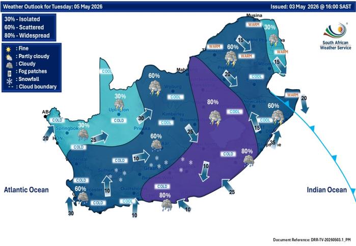
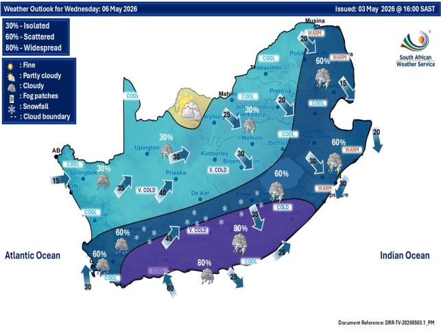
Tuesday–Thursday (5–7 May 2026)
Significant impacts expected in:
Eastern Cape coastline and interior Eastern parts of the Western Cape
Spreading into the Free State
Rainfall:
Widespread rainfall
100–200 mm in 24 hours possible
High risk of widespread flooding
Additional hazards:
Damaging winds
Very rough seas along southern coast
Expected Impacts
Flooding
Roads and settlements flooded
Mudslides
Damage to infrastructure
Strong Winds
Power outages
Damage to structures
Falling trees affecting transport
Rough Seas
Waves of 5–7 metres
Coastal damage
Harbour disruptions
Possible storm surge
Snowfall
Western Cape and Eastern Cape high ground
Livestock losses
Mountain pass closures
Severe Thunderstorms
Free State and North West
Local flooding
Small hail
Local damage
Public Advice
-Be cautious when travelling
-Avoid flooded roads and rivers
-Secure loose outdoor items
-Follow official SAWS updates
-Avoid spreading unverified information